
Real estate work needs proper records. Site visits, inspections, and reports depend on photos. But normal photos miss key details and lose value over time. GPS Map Camera solves this by adding important info on every photo. Below are the main features and how they help.
1. Location Stamp for Property Recognition
This feature shows the exact place on each photo. Every image is linked to a property. When many properties look alike, location-stamped photos clear all doubts during review.
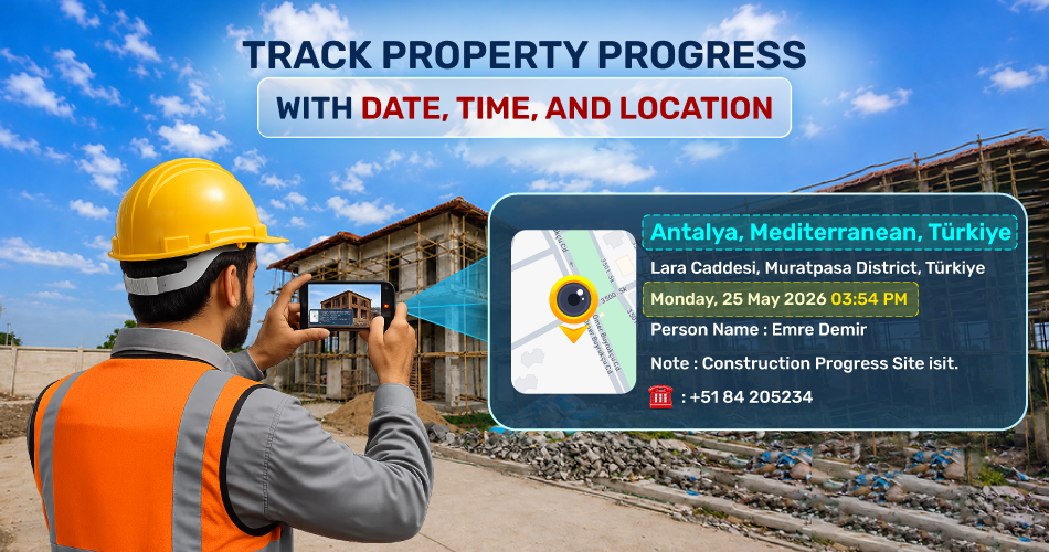
2. Latitude and Longitude for Site Accuracy
The app adds coordinates to photos. This helps in big projects, open plots, and new areas where addresses are not fixed. Coordinates work as solid proof for checks and audits.
3. Date and Time Stamp for Visit Record
The date and time on the photos show the exact day and time of the visit. In real estate, timing matters for approvals, handovers, and project stages. Auto timestamps stop disputes about visit dates.
4. Manual Location for Better Reading
Auto location names can look unclear. The manual location feature lets staff add a simple name like the project name, building number, or plot ID. Office teams can read it easily.
5. Notes and Text on Photo
Short notes can be written on the photo to explain the inspection stage or the site condition. No need to send extra messages.
6. Person Name for Accountability
This feature shows who clicked the photo. When many agents work together, it tracks each person's work. Later reviews become quick.
7. Folder-Based Photo Saving
Folder saving sorts photos by project, property, or task. This helps in fast access during reports and audits.
8. Custom File Naming
Photos can be saved with project codes, phase names, or inspection IDs. This makes work easier in shared drives and internal systems.
9. Before-and-After Photos
Used for construction progress, renovation, and repairs. Photos from the same spot with verified timestamps give strong visual proof of changes.
10. Long-Term Photo Info Storage
Photos keep their location and time info even after sharing. This helps in future reference, compliance, and history records.
Final Thought
GPS Map Camera is a feature-based tool that creates strong, verified photo records. It supports site visits, inspections, construction tracking, rental work, and reporting — all without making the job complex.