
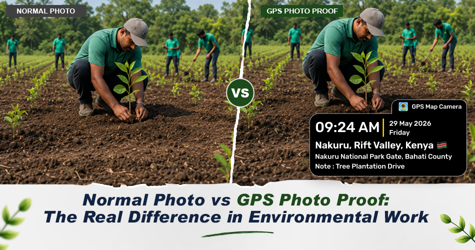
Environmental fieldwork is now judged by proof, not just effort. Tree plantation, pollution checks, forest surveys, or NGO projects — all need clear answers: Was this work really done? Photos help, but regular photos do not show where and when the work took place. GPS Map Camera adds location and time to every photo, turning simple images into trusted records.
1. Proof Is Important in Environmental Work
NGOs, government, CSR teams, and donors all want clear answers like:
- Was the work done at the right place?
- Is this photo new or reused?
- Does this photo really show fieldwork?
Without proof, even real work faces doubts. GPS photos answer these questions fast.
2. Problems with Normal Photos
Normal photos show visuals but miss key details:
- Similar sites look the same
- Dates need extra explanation
- Photos lose value in audits
This leads to more calls, follow-ups, and delayed approvals.
3. GPS Map Camera Solves This
GPS Map Camera adds key info on the photo at the time of capture. Each photo shows:
- Exact location
- Date and time
- Real ground condition
This info is added automatically, so reports stay clear and trusted.
4. Real Environmental Uses
- Tree Planting: Photos show the exact site and date as plantation proof.
- Plant Growth: Workers visit the same place later and take another photo. Before-and-after photos show real progress.
- Pollution or Waste Reports: GPS photos show the affected area clearly so officers can act fast.
5. Best Features for Environmental Work
- Location Stamp — City, area, and coordinates on the photo
- Date & Time feature — Shows when the work was done
- Notes on Photo — Add short info like plantation stage or check type
- Before-and-After Photos — Track progress over time
Simple but strong features for field use.
6. Who Uses GPS Map Camera?
- Environmental NGOs
- Tree plantation volunteers
- Forest and wildlife teams
- Environmental inspectors
- CSR and sustainability teams
Anyone doing fieldwork that needs proof can use it.
7. Why GPS Proof Matters in Reports
Environmental projects face strict checks today. Funding, audits, and public trust need clear proof. GPS Map Camera helps teams move from claim-based to proof-based reporting.
With GPS photos:
- Reports become stronger
- Data is more reliable
- Work gets more trust
Final Thought
Environmental workers do important work. That work needs honest and clear records. GPS Map Camera turns simple photos into real proof — showing what was done, where, and when.
It is not just about taking photos. It is about making proof that speaks for itself.