
Think about people who work in nature, science, safety, or even adventure. Wildlife researchers and environmental scientists need to show what the air felt like or how high up they were when they spotted a rare bird or plant. Disaster response teams must record wind speeds and pressure during storms to explain damage and keep reports clear.
Weather monitoring crews take photos that include real-time data like humidity or air pressure for reports and studies. Drone operators and aerial surveyors rely on altitude and GPS accuracy to prove exactly where they flew and how weather conditions affected their shots. Out at sea, marine workers and fishermen track wind and pressure to keep records for safety and to explain delays or rough conditions. Even miners and geologists stamp altitude and air pressure data to stay safe and record valuable information deep underground or on mountain sites.
Outdoor guides, hikers, and photographers also love these details because they help them document their climbs, treks, or photo shoots with the real conditions they faced.
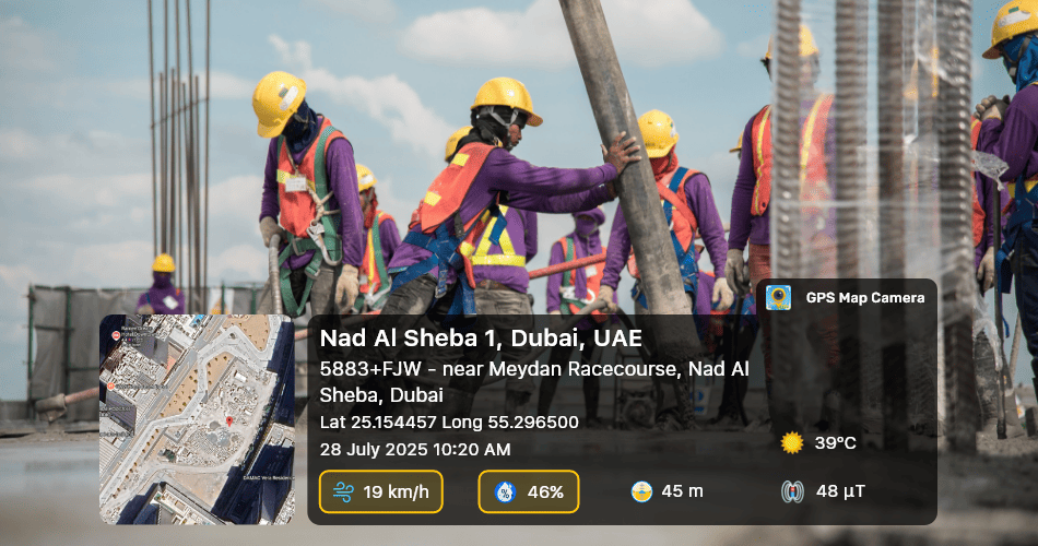
The GPS Map Camera app makes this easy by letting you stamp details like wind speed, humidity, pressure, altitude, and GPS accuracy directly onto your photos. Instead of just a picture, you now have a proper record with real facts.
These small details help avoid confusion, save time in reports, and make your photos solid proof of your work.
The GPS Map Camera app lets you choose how to show your data:
- Wind speed can be in km/h, mph, m/s, or knots
- Pressure can be in hPa, mmHg, or inHg
- Altitude can be in meters or feet
- Accuracy can be in meters or feet
This way, no matter where you work or what country you’re in, your photos show details in the units you use every day.
These stamps don’t just look smart—they turn your photo into a trusted record. You’ll know exactly where you were, what the weather was like, and how precise your location was. This is important for reports, studies, safety checks, or even legal records.
So, if you work on open fields, at construction sites, in remote landscapes, on mountain trails, on offshore platforms, or on high-altitude towers, try the Wind, Humidity, Pressure, Altitude, and Accuracy features in GPS Map Camera.