
Land surveyors face a big trust problem. Clients, government offices, and courts often ask if the survey was really done at the right place and on the right date.
You finish a boundary survey, send the report, and then the questions start:
- How do we know you went to the correct property?
- Can you prove the survey was done on that date?
- Where is the proof that you measured the exact boundaries?
Without strong proof, your name suffers and payment gets late. GPS Map Camera solves this fast.
The Hidden Problem with Normal Survey Photos
- No location proof — photos do not show GPS coordinates of the property
- No timestamp — clients cannot confirm the survey date, which causes payment disputes
- No accountability — no record of who did the survey and when
Result: many follow-up calls, late approvals, and weak proof in legal cases.
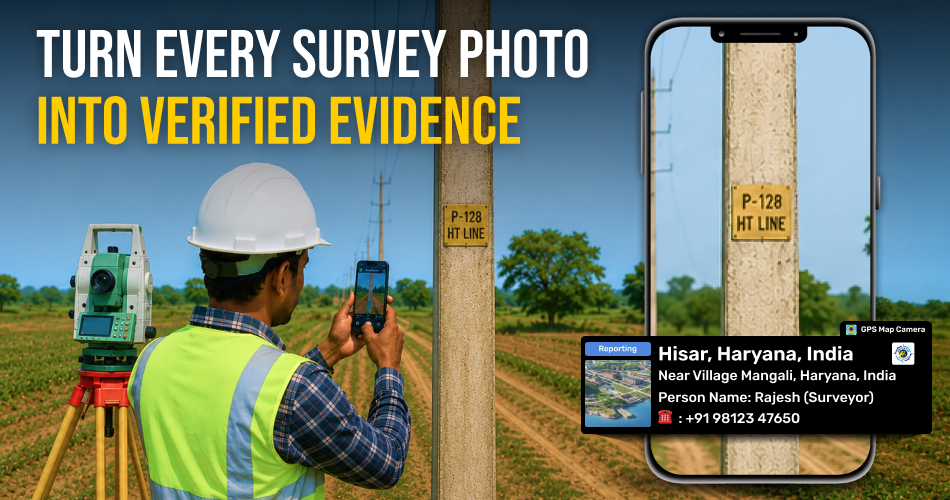
GPS Map Camera: Turn Every Photo into Legal Proof
GPS Map Camera adds key info on every survey photo:
- Exact GPS coordinates (matching property records)
- Auto date and time stamps (cannot be changed)
- Surveyor name and contact
- Notes for boundary markers and corner points
- Custom names like parcel number, plot ID, or survey code
Your survey photos become self-proving legal documents.
How It Solves Daily Survey Problems
- Prove the Right Property — Photos show exact coordinates that match official records. No confusion, even in similar plots.
- Confirm Survey Dates — Auto timestamps prove the date and time. Courts and land offices accept GPS proof in boundary cases.
- Find Boundary Markers Again — Each marker is saved with GPS coordinates. Return to the exact spot anytime with full accuracy.
- Faster Survey Reports — Photos sorted by location and date. File names include parcel numbers and survey codes. Reports get ready in less time.
- Track Team Work — Every photo shows surveyor's name, location, and time. Clear records of who did which survey.
Before vs After GPS Map Camera
- Before: clients doubt your work, no date or place proof, disputes become "your word vs theirs," hours wasted on photo work.
- After: GPS coordinates prove the right place, timestamps prove the date, proof stands in court, photos sort automatically, and you can return to markers easily.
Your survey work becomes strong, legal, and trusted.
Start Surveying with Proof, Not Promises
Download GPS Map Camera now and make your land survey work fully reliable.